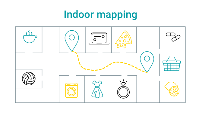
Indoor mapping is likely one of the most important forms of location navigation solutions available today. In buildings, it enhances guest experiences, offering valuable location services.
Guest benefits range from timely access to location-based communications in shopping malls (think in-app notifications for spot discounts and sales) to critical personal safety information during unexpected and potentially life-threatening events like fires.
Using indoor mapping software, organisations are also able to leverage smart applications that enable operational advantages. Deeper insights into guest behaviour, the ability to quickly and easily locate and identify assets, and use this information to run more efficient operations can lead to a stronger bottomline.
What is Indoor Mapping?
Indoor mapping is the means of using various technologies to determine the location of a device indoors. While indoor mapping shares similarities with GPS tracking, it does not rely on satellite tracking technology as satellite waves are not strong enough to penetrate roofs and walls. Instead, indoor mapping technology and indoor mapping software offer accurate information within buildings.
How Does Indoor Mapping Work?
Indoor mapping can be achieved with the use of various location-based technologies. Together, they work to help businesses identify the positions of users (device carriers), specific destinations and other assets.
Indoor mapping technology includes:

Proximity positioning is based on establishing direct contact or on a range of proximity between a receiver and a device. One of the most common examples is determining the distance between a WiFi access point and a smartphone.

Trilateration positioning is used to determine the location of an object with the use of several reference points. Typically, reference points are radio wave emitters.
Trilateration uses signal strength as a means for determining the distance between two objects.
The position of an object can be calculated in two ways. First, by using at least three fixed points (which are emitters of radio waves) in a 2D space or, secondly, through the use of four fixed points in a 3D space.
The object is located by pinpointing the intersection of a series of circles, as one would with a Venn diagram.

Fingerprinting positioning technologies leverage signal strength measurements across venues to determine the position of an object. Typically, signal strengths are measured, along with coordinates for each, and saved to a database for use. As new devices become available on a network, their location is mapped according to specific coordinates already collected.

Motion positioning inside venues can be determined with the use of smartphone technology. Smartphones make use of three components to help establish a device’s location. These components are:
- Accelerometers: measure acceleration and are equipped with axis-based motion-sensing capabilities.
- Gyroscope sensors: determine the orientation of a device. For example, turning your smartphone from portrait to landscape mode requires a gyroscope.
- Magnetometers: calculate the position of a smartphone in a physical space. It measures magnetic fields and is responsible for determining various compass bearings using a smartphone.
Data is used from the accelerometer, gyroscope sensor and magnetometer to provide accurate device coordinates.
Various technologies can be integrated to make indoor mapping possible.
For instance, proximity positioning can be paired with Quick Response (QR) codes capable of storing large amounts of data about locations, such as complete floorplan maps. When scanned by a visitor upon entry to a building, a QR code is able to provide a complete map along with highly accurate coordinate information to help the visitor easily locate points of interest.

Near-Field Communication (NFC) tags can be strategically placed throughout venues. When devices come within range of an NFC tag, the position of a smartphone can be updated in real-time.

Bluetooth low energy devices (beacons) are small battery-powered devices. They emit Bluetooth signals, making it possible to establish the location of an object accurately.
Other common technologies
Other examples include visible light communication which uses a smartphone camera to gather data from LED transmissions, ultrasound devices capable of measuring the time of flight (ToF) from one or multiple emitters to a receiver, thereby establishing position accuracy within centimetres.
WiFi access points are also common solutions for indoor mapping. As relatively inexpensive hardware, a WiFi network can be used along with various applications to identify and track an asset’s position.
Benefits of Indoor Mapping for the Guests
Convenience is the most obvious benefit guest experience when using indoor mapping software. As indoor mapping technology can be used in various building types (think airports, hospitals, university and corporate campuses, shopping malls, and more), guests are able to better navigate their way, especially if they are first-time visitors.
While convenience may seem hard to beat, safety is a strong contender. Indoor mapping software can be used as a means of communication with guests during potentially hazardous events.

Take the use of pop-up notifications. They allow site managers to quickly and easily broadcast messages to all visitors should a fire break out in a busy shopping mall. Centre management can broadcast a message directing shoppers away from a fire and to the closest exit.
Notifications can also be used to make visitors aware of their positions within venues. For instance, hospitals are large and often easy to get lost in. Indoor mapping software can be used as a simple but highly effective means of notifying visitors of their position as they search for a ward.
Additionally, access to timely marketing and sales offers based on user movement within a shopping mall is just as valuable. Spot discounts and sales offers can draw more shoppers to certain retailers for great deals.
Benefits of indoor mapping for venues
Managing traffic on busy sites is critical to preventing potential fire and safety hazards. By establishing the busiest routes in a venue, you can begin to design more optimised guest paths.
For example, when determining how to best design the layout of a site to help maximize revenue (think retail outlets in shopping malls and airports), access to indoor mapping technology helps companies understand how visitors explore and experience a location.
Knowing that passengers appreciate a cup of coffee before a flight, you’d be able to determine the best location for the coffee shop to ensure it’s patrons do not disrupt the flow of traffic or cause confusion or frustration for other passengers.
Indoor mapping software can also incorporate important data to uncover guest movement patterns. For example, traffic flow can also be used as an additional layer of information to better understand user behaviour.

By coupling traffic flow data with smart analytics applications, organisations can gain insights into visitor behaviour. Sites can better position sales and marketing offers for guests or design floor plans that position complimentary products shoppers need.
A Next-Generation Indoor Mapping Solutions are Within Reach
While indoor mapping software is versatile, building an indoor mapping solution involves pairing the right technologies. When assessing your needs, you’ll need to identify what type of environment you have, who visits your building and why, what type of challenges you face when managing your venue, and other important infrastructure considerations.
While various establishments will have unique challenges and receive different guests, the use of next-gen indoor mapping software can address these and many other hurdles organisations face.
For example, while investing in indoor mapping technology is a great idea, it’s often considered an expensive exercise. A next-gen indoor positioning mapping engine, like Linkyfi Location Engine, is capable of dramatically decreasing costs because it leverages an already-established WiFi network. This means less capital outlay on WiFi devices and enhanced functionality like heat mapping, analytics, API functionality, user tracking, proximity marketing and real-time navigation for guests.
Conclusion
For users, convenience, safety and access to timely information about the location make for elevated experiences.
For companies, indoor mapping technology and indoor mapping software present the opportunity to create better visitor experiences and can have a positive impact on their operations due to enhanced efficiency. Gains include deeper insights into user behaviour, the ability to design building layouts to better serve users, and strategically engage guests with targeted messaging.